History
History
Learn about the history of James Woodworth Prairie below.
Glacial and Post-Glacial

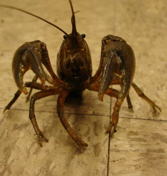
Glaciers covered this location only 17,000 years ago. The Woodworth Prairie is located just west of the crest of the Park Ridge Moraine, which runs north/south and divides the DesPlaines River basin from that of the Chicago River. Despite this short history the topsoil is over 40 cm thick. Crayfish are among the animals that help build the rich prairie topsoil. The period since the glaciers melted saw many changes in plant communities. Prairie eventually replaced different types of timbered communities as the climate got drier and burning became more frequent.
At night the crayfish waits at surface. The burrows of Procambarus gracilis may be 2 meters deep. The soil they bring to the surface often has much clay.
Ownership Period
The US government purchased land within the Indian boundary lines in 1818, but land outside those lines (such as JWP) was occupied before there was clear title. George Peacock was granted a land patent in 1843 when the US government decided to survey the land and issue titles. James Woodworth was mayor of Chicago in 1849. The Long family owned the prairie for a period, but the 10 acres of original prairie was owned by Peacock descendants when purchased by a developer in 1953. Four acres became a housing development in 1956 with the north border becoming a east/west line. There was also commercial development of the southwest corner, first as a go-cart track and later for miniature golf.
A map of parcels of land with the names of the owners in 1869. Diagonal road is Milwaukee Ave.
The prairie is in section 11 of town 41 north range 12 east of the 3rd Principle meridian. Nomally a township has 36 sections but a new baseline was established for T42N so T41NR12E (Maine Township) is truncated, i.e., does not have sections 1-6. (plat map obtained br Dr. Albert Rouffa.)
In 1949 the prairie was about 10 acres. Wetlands are visible as dark areas.
Scientists and people who were interested in prairie had been studying this area since at least 1926. When prairie friends detected the prairie being mowed to expand the golf business, they went to the developer and got a ‘stay of execution’. One of the people who did the most work to save this remnant from development, Bernice Popelka, is now writing a book about that effort. The Bernice Popelka Fund established at the U of I Foundation provides income essential to maintain and study the prairie.
In April of 1968 the University of Illinois at Chicago (UIC) acquired title to an abused prairie after securing grants from the Chicago Community Trust and LAWCON (Land and Water Conservation, a federal program).
This 1968 aerial photograph reveals the state of the prairie at the time it was ‘saved’. Note the outline of the go-cart track, the presence of the minature golf course on top of the track and the uneven north border
What is an original prairie and why is it valuable? Traditionally the term ‘virgin prairie’ has been used for remnants. I prefer ‘original’ to ‘virgin’ not for political correctness, but rather because despite diverse abuses this prairie has retained the collection of species characteristic of the original prairie. Management of JWP emphsizes maintaining autochthonous species, though some non-autochthonous prairie species have been introduced (see plant list).
Sometimes visitors ask ‘when was the prairie planted?’. This question surprises me, but reflects how disconnected human lives have become from nature and the dominance of ‘restoration’ as an activity in the conservation community.
Today, only 5 acres of the original prairie remain. It is surrounded by commercial and residential developments. These establishments contribute to the polluted run off, introduced species (non-native) and waste, which hurt the prosperity of the prairie.
A Google Earth Image taken 10 April 2002. Only the light brown patch in the east was unburnt in 2001-02 burn season.